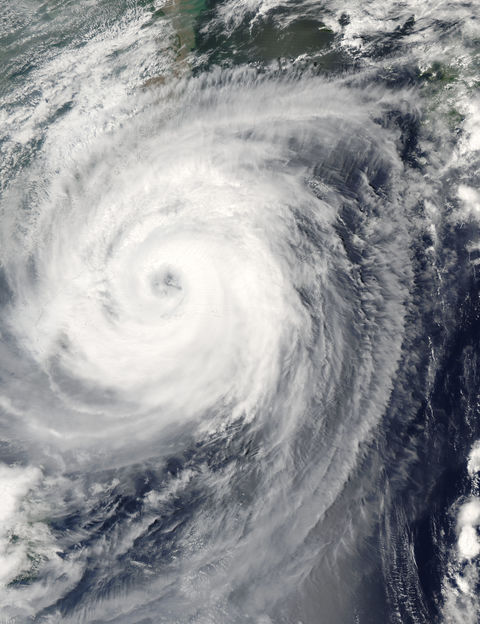
Typhoon Aere (20W) off China
The Moderate Resolution Imaging Spectroradiometer ( MODIS ) aboard NASAs Aqua satellite captured this true-color image of Typhoon Aere on August 24, 2004, at 4:40 UTC. At the time this image was taken, Aere was located approximately 185 km (115 miles) east-northest of Taipei, Taiwan and was slowly drifting towards the north-northwest at 9 km/hr (6 mph). Maximum sustained winds were near 148 km/hr (92 mph) with higher gusts to 185 km/hr (115 mph).
Gallery

