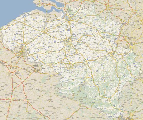
Belgium road map
Belgium road map.
The road network in Belgium is managed by regional authorities, meaning that a road section in Flanders is managed by the Flemish Government, a road section in Brussels by the Brussels government and a road section in Wallonia by the Walloon Government. This explains that road signs in Flanders are written in Dutch, even when referring to a Walloon region, and conversely, which can be confusing for foreigners who do not know the different translations of Flemish or Walloon cities in the other language. The road network in Belgium is made of highways, national (or regional) roads (the secondary network) and communal roads (or streets). Communal roads are managed at the municipal level. There are also a number of orbital roads in Belgium around major cities.
The road network in Belgium is managed by regional authorities, meaning that a road section in Flanders is managed by the Flemish Government, a road section in Brussels by the Brussels government and a road section in Wallonia by the Walloon Government. This explains that road signs in Flanders are written in Dutch, even when referring to a Walloon region, and conversely, which can be confusing for foreigners who do not know the different translations of Flemish or Walloon cities in the other language. The road network in Belgium is made of highways, national (or regional) roads (the secondary network) and communal roads (or streets). Communal roads are managed at the municipal level. There are also a number of orbital roads in Belgium around major cities.
- total: 152,256 km (2006)
- country comparison to the world: 35
- paved: 119,079 km (including 1,763 km of expressways)
- unpaved: 33,177 km

