Bay of Cádiz map 17??
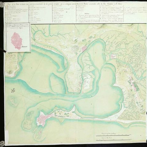
Bay of Cádiz map showing the great advantages achieved with the work of the bridges built over the rivers Guadalete and Sn. Pedro
Manuscript on paper pen illuminated with gouache in green and crimson Oriented with a lily with the N. at the NW. of the map. - Directions. - Relief by shading. - Trees Represented with schematic maps of the Puerto de Santa María, Puerto Real, La Carraca, Isla de León and Cádiz. - Also includes superimposed in the upper left: "The city of Xerez de la Frontera. It lies to the NNE. of the Puerto de Santa Maria in a distance two leagues".
Manuscript on paper pen illuminated with gouache in green and crimson Oriented with a lily with the N. at the NW. of the map. - Directions. - Relief by shading. - Trees Represented with schematic maps of the Puerto de Santa María, Puerto Real, La Carraca, Isla de León and Cádiz. - Also includes superimposed in the upper left: "The city of Xerez de la Frontera. It lies to the NNE. of the Puerto de Santa Maria in a distance two leagues".

