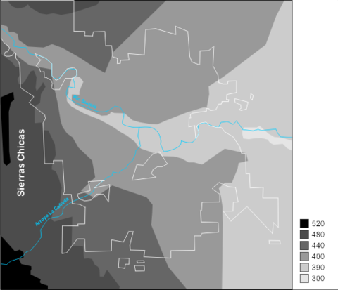
Terrain map of the City Córdoba, Argentina
Terrain map of the City Córdoba, Argentina with names. Scale of relief given in meters above sea level. City line indicated in white line. Main river and stream indicated in blue line.
The city is located in the plain of the Humid Pampa, to the east of the oriental cord of Córdoba Hills or Sierras Chicas, also known as the Sierras Cordobesas, which has an average height of 550 m. It spreads at the foot of the mount, on both banks of the River Suquía, and flows into the San Roque reservoir; from there, the Primero River goes east into the plains surrounding the city of Córdoba.
Once inside the city, the La Cañada stream meets the Rio Primero near the city centre area. Two kilometers to the east, Isla de los Patos (Ducks Island) was repopulated with ducks and swans in the 1980s. It was reported in March 2006 that a large number of ducks had died due to unspecified causes. Pollution caused by chemical waste is suspected as the cause, but avian influenza is also being investigated.
Beyond the city limits, the river flows towards the Algarrobos swamp and ends its course on the southern coast of the Mar Chiquita (or Mar de Ansenuza) salt lake. All in all, the river has a length of approximately 200 km (124 mi) and carries, on average, 9.7 m³/s, with minimum of 2 m³/s and maximum of 24 m³/s with a peak during the summer months.

