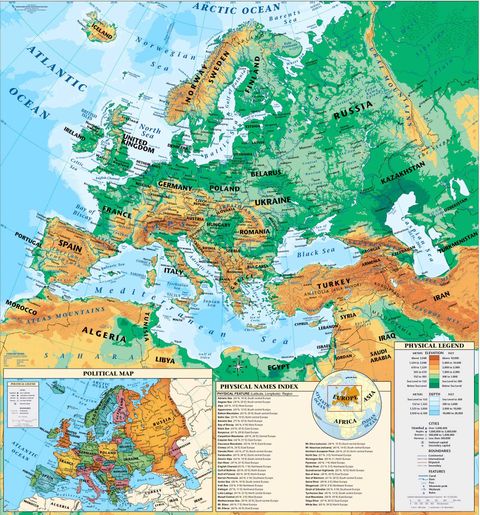
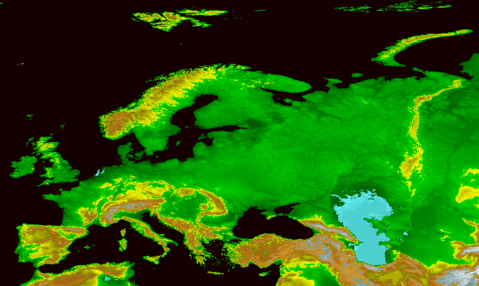
Europe physical map
Europe physical map.
Europe is the second smallest continent in the world, just behind Oceania. It is united to Asia, forming a huge peninsula within what is called Eurasia, and owes its characteristics of individuality, as much to its physical elements, as to its historical and human features.
It limits with the sea for three of the four cardinal points. Broadly speaking, with the Arctic Ocean to the north, the Atlantic Ocean to the west and the Mediterranean Sea to the south, and its wide façade formed by almost 38,000 km of coastline, which shows a very important oceanic influence. Oceanic influence that comes to characterize it as one of its most important physical features, determining the climate in most of the continent. To the east its boundary is continental and, according to most geographers, it is situated at the eastern foot of the Ural mountains, the Ural River, the Caucasus mountain range and the Black Sea up to the Sea of Marmara.


