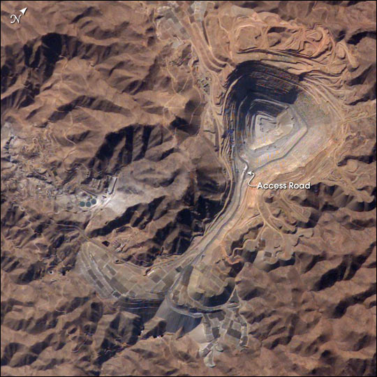
Toquepala Copper Mine, Southern Peru. The rugged, mineral-rich Andes support some of the world’s biggest mines (gold, silver, copper, and more). This image looks down the bull’s-eye of Peru’s Toquepala copper mine, a steep sided and stepped open-pit mine. Mid-afternoon sunlight on the arid slopes of the central Andes mountains provides an accent to the mine contours. At the surface the open pit is 6.5 km across and it descends more than 3000 m into the earth. A dark line on the wall of the pit is the main access road to the bottom. Spoil dumps of material mined from the pit are arranged in tiers along the northwest lip of the pit. Numerous angular leaching fields appear lower right, and the railroad to the coast is a line that exits the image center left. The railroad was built to export Toquepala’s copper and connects the coastal port of Ilo, 95 km to the southwest
|
|