See full-size image (239KB).
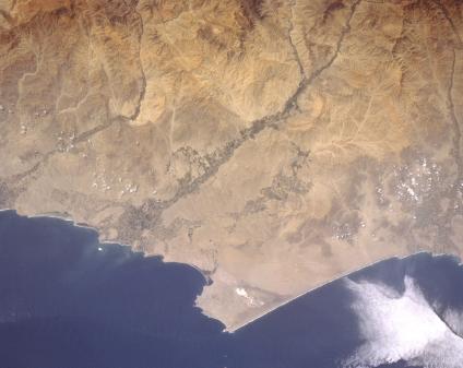
Huacho Area, Peru May 1997. This particular section of the Peruvian coast northwest of Lima is located in a desert climate. Here it is so arid that only the intermittently flowing rivers provide adequate moisture to support irrigated agriculture in the river valleys and floodplains (note the darker linear features aligned east-west in the image). Many of the deeply incised, short flowing rivers drop dramatically in elevation from 15000 feet (4572 meters) elevation in the Andes Mountains to sea level in less than 50 miles (80 kilometers). The small, brighter features that are visible on the peninsula that juts westward into the Pacific Ocean are the salt pans of mining operations. The tiny town of Huacho is located at the coast near the Rio de Huaura, just north of the large peninsula where the agricultural field pattern is most extensive.
