See full-size image (199KB).
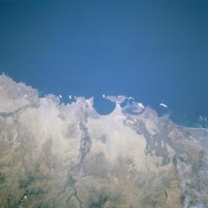
Chimbote Area, Peru May 1997. The west central coast of Peru north of Lima offers of a variety of peninsulas and small bays. The narrow coastal plains are covered with light-colored, sandy soils that strongly contrast with the Pacific Ocean. The only breaks in this desert landscape are where the river valleys or channels provide sufficient water for irrigated agriculture. Three distinct (darker textured) agricultural areas are observed here. The largest is located inland from the urban area of the seaport city of Chimbote (located along the northern shore of the second largest bay). Two extensive areas of cultivated field patterns are also observed along the floodplains of the Rio Nepena and Rio Casma, respectively, reaching the coast further south. The western slopes of the Andes Mountains are visible along the bottom of the image.
