See full-size image (689KB).
From: NASA
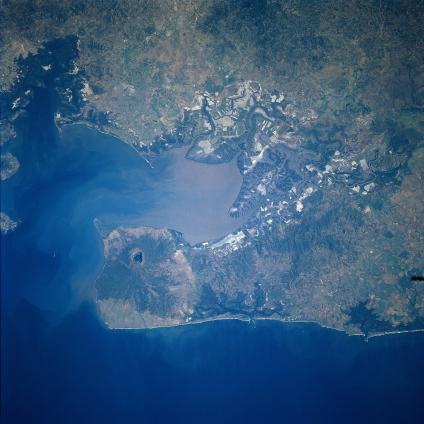
Coseguina Volcano, Nicaragua January 1997. This near-nadir view shows the Gulf of Fonseca and Coseguina Volcano in northwest Nicaragua. Coseguina is a basaltic shield volcano with a large central collapsed crater that contains a lake. Coseguina has also been referred too by some volcanologists as a stratovolcano. The volcano has an elevation of 2777 feet (847 meters). The crater is about 1.2 miles (2 km) by 1.5 miles (2.5 km) in diameter and is 1640 feet (500 meters) deep. The crater of Coseguina Volcano was formed during an explosive eruption that occurred on January 22, 1835. Ash and pumice from the eruption covered a large area of Central America and Mexico depositing ash as far as Mexico City, some 869 miles (1400 km) to the north, and the island of Jamaica, some 800 miles (1300 km) to the east. The volcanoes eruption cloud blocked out the sun in a 93-mile (150 km) wide radius. Coseguina erupted again explosively in 1852 producing lava flows. The last recorded eruption was in 1859. The lake seen in the crater began to form in 1938.
