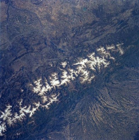
The Pyrenees Mountains, France and Spain
The east to west trending snow capped Pyrenees Mountains form a natural border between France (north-bottom) and Spain (south-top). The landscape of the landforms on either side of the mountains is dramatically different. Large, alluvial fans can be seen radiating northward providing rich soils for a thriving agricultural economy on the French side of the mountains. While south of the mountains in Spain, the landscape is more rugged with numerous escarpments and steep cliffs that parallel the main axis of the Pyrenees. Within the higher elevations of the Pyrenees, numerous, deep glacially formed U-shaped valleys are arrayed in no set pattern. The picturesque but rugged terrain of the Pyrenees Mountains offer a natural environment for a variety of tourist attractions that includes hiking trails, sightseeing venues, health spas, winter and summer sports. The Principality of Andorra, a small mountainous country with only 187 square miles (486 square km) of territory and an estimated population of 63000 permanent residents, can be located towards the lower left corner of the image.

