Foxe Basin, Canada
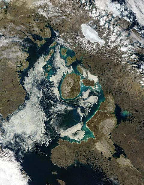
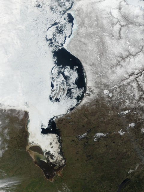
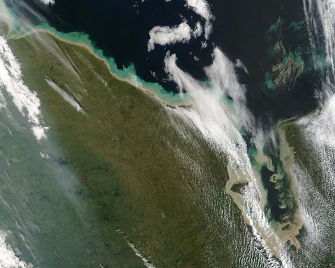
Sea ice, sediment, and phytoplankton abound in this true-color Terra MODIS image of Foxe Basin acquired August 1, 2002. Foxe Basin separates Baffin Island (right) from Nunavut Canada (left) and is separated from the Hudson Bay by Foxe Channel (bottom). Toward the middle right edge of the Basin is Prince Charles Island. Prominent in the image are large amounts of melting sea ice that create peculiar patterns and textures. Many of the islands and shorelines seem to have glowing turquoise haloes. Most of the haloes are due to sediment and silt in the water reflecting sunlight, but some farther out in the water is likely due to the presence of phytoplankton, which thrive in cold, nutrient-rich waters such as these. The chlorophyll in the phytoplankton reflect the sunlight and appear blue-green in color.
Gallery

