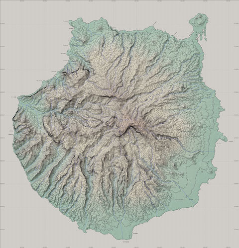
Topographic map of the Gran Canaria Island 2007
Topographic map of the Gran Canaria Island 2007. Data of origin: Shuttle Radar Topography Mission [NASA]. 3 secs. of arc. Data of projection: UTM Map projection. WGS84 Ellipsoid. UTM zone 28N. Equidistance of curves: 50 m.


