Africa Map
Africa Map.
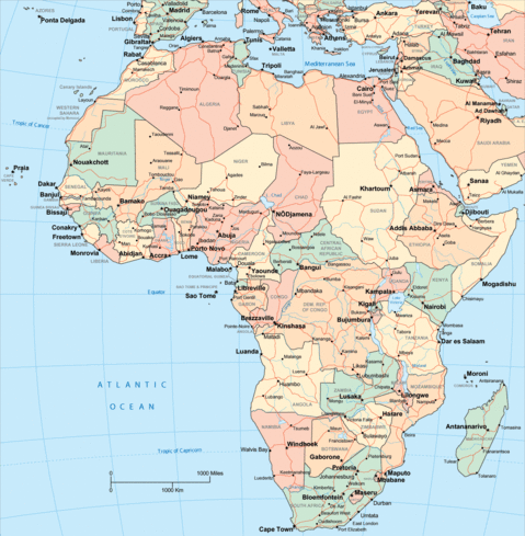
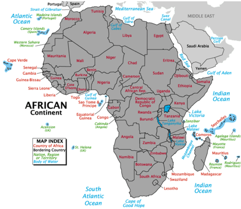
Africa is the second largest continent and the second most populated in the world, and is behind Asia in both categories. It is located between the Atlantic to the west and the Indian Ocean, to the east. The Mediterranean Sea separates it north from the European continent; the point where the two continents are closest is the 14.4 km wide Strait of Gibraltar. The Red Sea separates it to the east of the Arabian peninsula and it is united to Asia through the isthmus of Suez, in Egyptian territory. It has a total area of 30 272 922 km² (621 600 km² in insular mass), which represents 20.4% of the total land surface of the planet. The population is one billion inhabitants, less than 15% of the world total. The continent is divided into 54 sovereign states, plus two states with limited recognition and two dependent territories.
Africa is the second largest continent and the second most populated in the world, and is behind Asia in both categories. It is located between the Atlantic to the west and the Indian Ocean, to the east. The Mediterranean Sea separates it north from the European continent; the point where the two continents are closest is the 14.4 km wide Strait of Gibraltar. The Red Sea separates it to the east of the Arabian peninsula and it is united to Asia through the isthmus of Suez, in Egyptian territory. It has a total area of 30 272 922 km² (621 600 km² in insular mass), which represents 20.4% of the total land surface of the planet. The population is one billion inhabitants, less than 15% of the world total. The continent is divided into 54 sovereign states, plus two states with limited recognition and two dependent territories.


