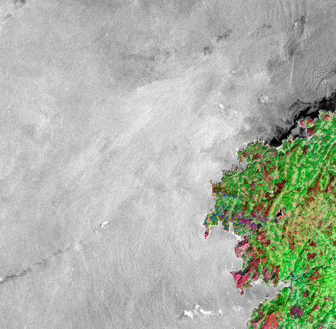
Oil Slick Along the Spanish Coast
A damaged oil tanker off the northwest coast of Spain split in half on Tuesday (November 19, 2002), creating a series of large oil slicks. The tanker was carrying more than 20 million gallons of oil, but it is unknown how much has spilled, and how much remains onboard the sunken ship. The ship was originally damaged (and started leaking oil) on November 13. The oil has already washed up on some beaches, and threatens a Portuguese nature preserve. The image above shows the oil slick with data from the Canadian RADARSAT satellite. Black areas indicate the location of the slick on November 18. Oil slicks are visible from RADARSAT because the oil smooths the ocean surface. Radar waves bounce off the smooth surface and away from the satellite instrument. The surface of clean water is rough, so some of the radar waves are scattered back towards the instrument. Therefore, clean water appears bright. The Spanish coast is shown in color with Landsat data. The coastal town of A Coruña is located near the center of this image (on the point of land just above the 3-mile marker overlay).


