Guadalquivir River satellite view
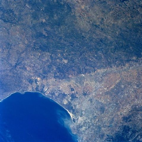
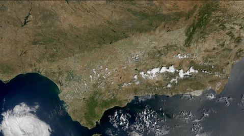
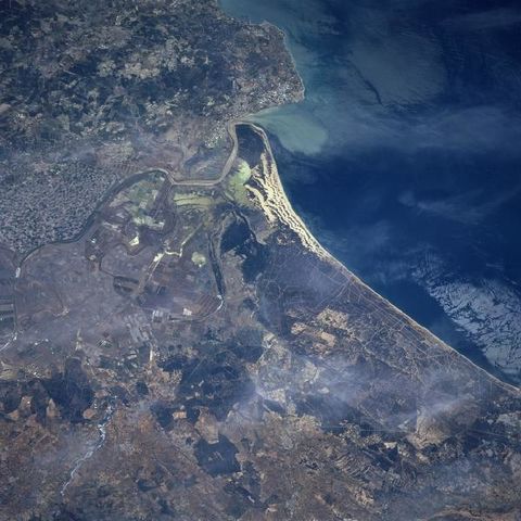
Geologically this image can be divided into an old massif (darker looking landscape center top) and an extensive, wedge-shaped depression, alluvial plain (lighter colored region) that is located south of the low mountains. Faulting has produced the distinct and fairly abrupt color change between the two physiographic features. Faulting within the Morena Mountains, however, is generally aligned in a northwest-southeast orientation. The Guadalquivir River is visible as it meanders and flows in a westerly direction along the southern edge of the Morena Mountains in southwest Spain. The location of Spain's third largest city, Seville (estimated population 800000), is barely visible along the east bank of the Guadalquivir River, after the river takes a more southerly course towards the Gulf of Cadiz. The river mouth is visible by the light-colored sediment plume that is being dispersed northwestward along the coast. A sizable wildlife sanctuary and the Donana National Park with it's extensive beach area and moving sand dunes, as well as a marshy landscape inland from the coast is located immediately north of the mouth of the Guadalquivir River. An intricate network of irrigation canals is also discernible between Seville and the mouth of the river.


