Saint Kitts and Nevis Physical Map 1996
Saint Kitts and Nevis, officially the Federation of Saint Kitts and Nevis or also the Federation of Saint Christopher and Nevis, is a North Antillean country, specifically the Windward Islands, owing its name precisely to this pair of islands. Christopher Columbus colonized these islands on his second trip to this continent, calling the largest San Cristóbal in honor of the colonizer of America and Nieves the second because of the snow on its summit (actually caused by clouds), alluding to a miracle. of the Virgin Mary with the invocation of Our Lady of the Snows and occurred on Mount Esquilino, in Rome, in the 4th century.
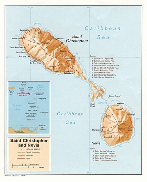
It is the smallest country in the American continent, both in size and population. Saint Kitts and Nevis have an area of 261 km² and a population of 54,961 inhabitants. Its capital and most populous city is Basseterre, in Saint Kitts.
The two islands are separated by a shallow channel called The Narrows of 3 km. The highest peak of the islands is located in Saint Kitts, it is Mount Liamuiga with an altitude of 1156 m. Most of the population on the island are descendants of African slaves. The two islands were home to the first British and French colonies in the Caribbean, which is why it has also been titled "The mother colony of the West Indies."