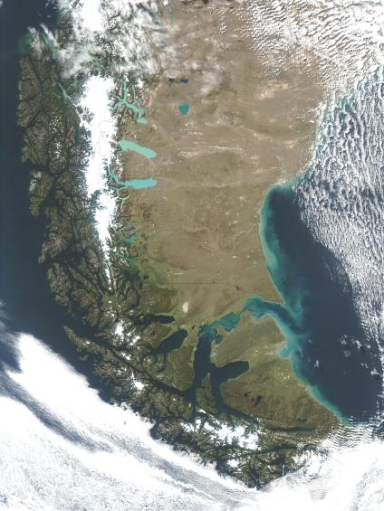
See full-size image (518KB).
Credit: Jeff Schmaltz, MODIS Rapid Response Team, NASA/GSFC
The Tierra del Fuego a group of islands at the southern tip of South America have some of the worst weather in the world. The rugged islands poke into the ocean current circling Antartica, and are almost continuously battered by high winds and covered by clouds. On March 28, 2003 an early fall day the Moderate Resolution Imaging Spectroradiometer (MODIS) instrument aboard NASAŽs Terra satellite captured this rare view of the islands and the Patagonia region of South America. Even in this image, however, Cape Horn, the southernmost point on the continent, remains cloudy. Magellan sailed between the Tierra del Fuego and the mainland in 1520 during his around the world expedition. Magellan named the region the Land of Fire when he saw fires along the southern shore of the Strait of Magellan. Subsequent settlement brought iseases which destroyed these cultures. The western Tierra del Fuego now belong to Chile, and the eastern side is part of Argentina.
