- World ::
- North America ::
- Quebec
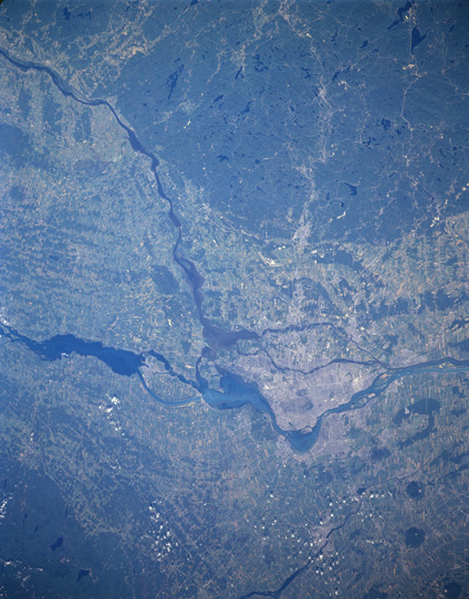
Satellite Image, Photo of the Montreal Area, Quebec
See full-size image (3.61MB).
From: NASA
Montreal Area, Quebec, Canada August 1997. Montreal is located just east of the confluence of the Ottawa River (the west-to-east dark feature) and the St. Lawrence River. While the small scale of the image precludes the identification of specific urban infrastructure within Montreal, the lighter, built up area can be located on the islands east of the Ottawa-St. Lawrence Rivers junction. The extensive dark-looking area with numerous lakes (very dark irregular shaped features) north of Montreal is forested and glaciated landscape. Similarly, the darker terrain along the southern edge (and south of the St. Lawrence River) of the picture is a glaciated and forested region in upstate New York. Lighter colored, angular land use patterns in the river floodplain are agricultural fields or pastureland.
