- World ::
- North America ::
- Quebec
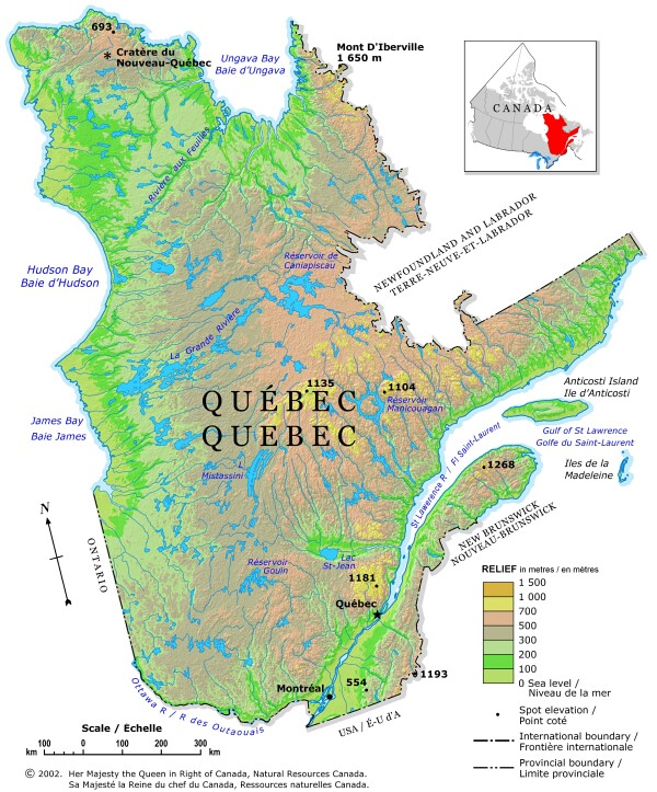
Quebec Shaded Relief Map 2002

This map is from the Atlas of Canada © 2006. It has been reproduced under license from Her Majesty the Queen in Right of Canada with permission from Natural Resources Canada.
A relief map of Quebec showing elevation by hypsometric tints, (a gradation of different colours), and spot elevations. Major lakes are also shown. Elevation ranges are included in the map legend.